Guatemalan authorities have issued a nationwide orange alert following the eruption of the Fuego volcano. The eruption began on a Monday morning and increased in intensity throughout the day, according to Claudinne Ogaldes, executive secretary of the disaster management agency CONRED.
The Guatemalan Seismology, Vulcanology, Weather and Water Institute reported that the level of explosiveness is increasing. A lava fountain between 200m and 300m has developed over the crater of the Fuego volcano.
As a preventive measure, CONRED has begun evacuating the village of El Porvenir and the hamlet of Las Lajitas. The evacuation involves approximately 50 families or 250 people.
Infrastructure and local impact
National Route 14, a major highway passing close to the volcano, has been closed. Additionally, the education ministry suspended classes in towns located near the Fuego volcano.
The Fuego volcano is located either 35 kilometres from Guatemala City or 50 kilometres southwest of the city. The volcano is one of the most active in Central America.
Historical context
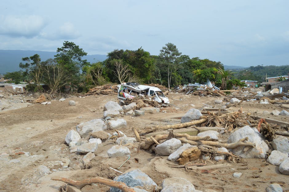
A previous eruption of the Fuego volcano in June 2018 destroyed a village and killed hundreds of people, with some reports specifying approximately 200 deaths. Authorities stated that the 2018 eruption affected up to 1.7 million people.
Updates
The Fuego volcano is experiencing its 'most intense phase,' with columns of lava, gas, and ash reaching approximately 4 kilometers into the sky. Ash clouds have traveled 60 kilometers to the west, potentially disrupting air traffic, while authorities have advised extreme caution within a 10-kilometer radius. Additionally, some local businesses have temporarily shuttered, and reports indicate onlookers are still climbing the nearby Acatenango volcano despite safety bans.
The Fuego volcano is entering its 'most intense phase,' with lava, gas, and ash columns reaching approximately 4 kilometers into the sky. Ash clouds have traveled 60 kilometers to the west, potentially disrupting air traffic, while CONRED has advised residents to stay clear of a 10-kilometer radius and prepare 72-hour emergency kits. Local businesses in the vicinity have also temporarily shuttered due to the increased activity.
The Fuego volcano is currently experiencing its 'most intense phase,' with lava, gas, and ash columns reaching approximately 4 kilometers into the sky and ash clouds spreading 60 kilometers to the west. CONRED has warned of potential air traffic disruptions and advised residents within a 10-kilometer radius to exercise extreme caution, keep windows closed, and prepare 72-hour emergency kits. Additionally, some local businesses have temporarily shuttered, while reports indicate onlookers are still climbing the nearby Acatenango volcano despite safety bans.
The Fuego volcano has entered its 'most intense phase,' ejecting columns of lava, gas, and ash approximately 4 kilometers into the sky. Ash clouds have traveled up to 60 kilometers west, potentially causing significant air traffic disruptions according to CONRED. Consequently, authorities have advised extreme caution within a 10-kilometer radius and recommended that residents prepare 72-hour emergency kits.
The Fuego volcano has entered its most intense phase, spewing columns of lava, gas, and ash approximately 4 kilometers into the sky. Ash clouds have traveled up to 60 kilometers to the west, prompting CONRED to warn of potential air traffic disruptions and advise residents to keep windows closed and prepare 72-hour emergency kits. Additionally, authorities have advised extreme caution within a 10-kilometer radius, even as local media reports onlookers continuing to climb the nearby Acatenango volcano despite safety bans.
The Fuego volcano is experiencing its 'most intense phase,' with lava, gas, and ash columns reaching approximately 4 kilometers into the sky and ash clouds traveling 60 kilometers to the west. CONRED has warned of significant air traffic disruptions and advised residents to prepare 72-hour emergency kits, while local media reported that some onlookers are violating safety bans by climbing the nearby Acatenango volcano. Additionally, some local businesses have temporarily shuttered as authorities advise extreme caution within a 10-kilometer radius.
The Fuego volcano is currently experiencing its 'most intense phase,' with lava, gas, and ash columns reaching approximately 4 kilometers into the sky. Ash clouds have traveled up to 60 kilometers west, potentially causing significant air traffic disruptions according to CONRED. Authorities have advised extreme caution within a 10-kilometer radius, while pyroclastic flows continue to move down the southeastern slope.
The Fuego volcano is currently in its most intense phase, with lava, gas, and ash columns reaching approximately 4 kilometers into the sky. Ash clouds have traveled up to 60 kilometers west of the volcano, prompting CONRED to warn of significant air traffic disruptions and advise residents to prepare 72-hour emergency kits. Additionally, pyroclastic flows were reported moving down the southeastern slope as of early Tuesday.
The Fuego volcano has entered its most intense phase, spewing columns of lava, gas, and ash approximately 4 kilometers into the sky. Ash clouds have traveled up to 60 kilometers west, potentially disrupting air traffic, while pyroclastic flows continue to move down the southeastern slope. In response, authorities have advised extreme caution within a 10-kilometer radius and recommended that residents prepare 72-hour emergency kits.
The Fuego volcano is currently in its 'most intense phase,' with lava, gas, and ash columns reaching approximately 4 kilometers into the sky. Ash clouds have traveled up to 60 kilometers west, potentially disrupting air traffic, while pyroclastic flows continue to move down the southeastern slope. Consequently, authorities have advised extreme caution within a 10-kilometer radius and instructed residents to prepare 72-hour emergency kits.
The Fuego volcano is currently experiencing its 'most intense phase', with lava, gas, and ash columns reaching approximately 4 kilometers into the sky. Ash clouds have traveled up to 60 kilometers west, potentially disrupting air traffic, while pyroclastic flows continue to move down the southeastern slope. Consequently, authorities have advised extreme caution within a 10-kilometer radius and issued emergency preparations, such as keeping windows closed and preparing 72-hour kits.
The Fuego volcano has entered its most intense phase, spewing columns of lava, gas, and ash approximately 4 kilometers into the sky. Ash clouds have traveled up to 60 kilometers west, potentially disrupting air traffic, while authorities have warned that communities on the western and southern flanks face the greatest risk from hot volcanic debris flows. In response, the Guatemalan education ministry has suspended face-to-face classes in two nearby municipalities, and traffic police have closed the road connecting the south coast with Antigua.
The Fuego volcano has entered its most intense phase, with lava, gas, and ash columns reaching approximately 4 kilometers into the sky. Ash clouds have traveled 60 kilometers west, posing potential disruptions to air traffic, while pyroclastic flows continue to move down the southeastern slope. Consequently, authorities have closed a road connecting the south coast to Antigua, and the education ministry has suspended face-to-face classes in two nearby municipalities.
The Fuego volcano has entered its most intense phase, spewing columns of lava, gas, and ash approximately 4 kilometers into the sky. Volcanic ash clouds have traveled up to 60 kilometers west, prompting CONRED to warn of potential air traffic disruptions and advise residents to keep windows closed and prepare 72-hour emergency kits. Additionally, the Guatemalan education ministry has suspended face-to-face classes in two nearby municipalities, and traffic police have closed the road connecting the south coast with Antigua, Guatemala.
The Fuego volcano is currently in its 'most intense phase,' with lava, gas, and ash columns reaching approximately 4 kilometers into the sky and ash clouds spreading 60 kilometers to the west. CONRED has warned of potential air traffic disruptions, while local authorities have suspended face-to-face classes in two nearby municipalities and closed the road connecting the south coast with Antigua. Additionally, firefighters have transported at least 350 residents from El Porvenir and Las Lajitas to San Juan Alotenango, as pyroclastic flows continue to move down the southeastern slope.
The Fuego volcano is experiencing its 'most intense phase' as lava, gas, and ash columns reach approximately 4 kilometers into the sky. Ash clouds have traveled 60 kilometers to the west, potentially disrupting air traffic, while authorities have advised extreme caution within a 10-kilometer radius. Additionally, the Guatemalan education ministry has suspended face-to-face classes in nearby municipalities, and traffic police have closed the road connecting the south coast with Antigua.
The Fuego volcano has entered its most intense phase, with lava, gas, and ash columns reaching approximately 4 kilometers (2.5 miles) into the sky. Ash clouds have moved as far as 60 kilometers (37 miles) to the west, potentially disrupting air traffic, while pyroclastic flows continue to descend the southeastern slope. In response, authorities have closed roads connecting the south coast to Antigua, suspended face-to-face classes in nearby municipalities, and advised residents to prepare 72-hour emergency kits.
The Fuego volcano has entered its most intense phase, sending columns of lava, gas, and ash approximately 4 kilometers into the sky with ash clouds traveling 60 kilometers to the west. Authorities have advised extreme caution within a 10-kilometer radius, warned of potential air traffic disruptions, and ordered the suspension of face-to-face classes in two nearby municipalities. Additionally, firefighters have transported at least 350 residents from El Porvenir and Las Lajitas to San Juan Alotenango, while traffic police closed a key road connecting the south coast to Antigua.
The Fuego volcano has entered its 'most intense phase,' spewing lava, gas, and ash columns approximately 4 kilometers (2.5 miles) into the sky. Ash clouds have traveled up to 60 kilometers (37 miles) west, potentially disrupting air traffic, while pyroclastic flows continue to move down the southeastern slope. Consequently, authorities have advised extreme caution within a 10-kilometer radius, and the education ministry has suspended in-person classes in two nearby municipalities.
Guatemalan authorities have upgraded the warning to a red alert, the highest emergency level, for the departments of Sacatepéquez, Chimaltenango, and Escuintla. The eruption has affected approximately 29,000 people, primarily due to ashfall that is dispersing at altitudes between 5,000 and 6,000 meters and traveling up to 130 kilometers toward the west and northwest. Additionally, the National Civil Police have blocked access to the nearby Acatenango volcano to ensure public safety.
Guatemalan authorities have officially declared a red alert, the highest emergency level, for the Sacatepéquez, Chimaltenango, and Escuintla departments. Approximately 29,000 people have been affected by the eruption, primarily due to ashfall, while CONRED spokesperson Valeria Urízar noted that ash clouds are traveling up to 130 kilometers to the west and northwest. Additionally, the National Civil Police has blocked access to the nearby Acatenango volcano to protect lives, and the education ministry has suspended face-to-face classes in communities near the volcano.
Guatemalan authorities have upgraded the warning to a red alert, the highest emergency level, for the departments of Sacatepéquez, Chimaltenango, and Escuintla. The eruption has affected approximately 29,000 people, primarily due to ashfall that is dispersing at altitudes between 5,000 and 6,000 meters and traveling up to 130 kilometers to the west and northwest. Additionally, the National Civil Police has blocked access to the nearby Acatenango volcano to protect lives.
Guatemalan authorities have upgraded the situation to a red alert, the highest emergency level, for the departments of Sacatepéquez, Chimaltenango, and Escuintla. This escalation follows reports that ash clouds have extended up to 130 kilometers to the west and northwest, affecting approximately 29,000 people. Additionally, the National Civil Police has blocked access to the nearby Acatenango volcano to prevent people from climbing it to observe the eruption.
Guatemalan authorities have escalated the warning to a red alert, the highest emergency level, for the departments of Sacatepéquez, Chimaltenango, and Escuintla. This intensification follows reports that the eruption, which began on August 4, has caused ash clouds to travel up to 130 kilometers and has affected approximately 29,000 people. Additionally, the National Civil Police has blocked access to the nearby Acatenango volcano to prevent tourists from climbing it during the eruption.
Guatemalan authorities have upgraded the warning to a red alert, the highest emergency level, for the departments of Sacatepéquez, Chimaltenango, and Escuintla. This escalation comes as volcanic ash clouds have been observed extending up to 130 kilometers to the west and northwest, and approximately 29,000 people have been affected by the eruption. Additionally, the National Civil Police have blocked access to the nearby Acatenango volcano to protect lives following reports of people attempting to climb it to film the eruption.
Guatemalan authorities have upgraded the warning to a red alert, the highest emergency level, for the departments of Sacatepéquez, Chimaltenango, and Escuintla. Additionally, CONRED reported that approximately 29,000 people have been affected by the eruption, primarily due to ashfall. The Institute of Volcanology warned that increasing pyroclastic flows constitute the main threat to nearby localities.
Guatemalan authorities have upgraded the status to a red alert, the highest emergency level, for the departments of Sacatepéquez, Chimaltenango, and Escuintla. CONRED spokesperson Valeria Urízar reported that the eruption has affected approximately 29,000 people, primarily due to ashfall. Additionally, the Guatemalan education ministry has suspended face-to-face classes in schools across three nearby localities as a precautionary measure.
Guatemalan authorities have upgraded the warning to a red alert, the highest emergency level, for the departments of Sacatepéquez, Chimaltenango, and Escuintla. Approximately 29,000 people have been affected by the eruption, primarily due to ashfall extending up to 130 kilometers west and northwest. Additionally, the education ministry has suspended face-to-face classes in three nearby localities, and police have blocked access to the nearby Acatenango volcano.
Guatemalan authorities have upgraded the emergency status to a red alert—the highest level—for the departments of Sacatepéquez, Chimaltenango, and Escuintla. Approximately 29,000 people have been affected by the eruption, primarily due to ashfall, while ash clouds have been observed extending up to 130 kilometers to the west and northwest. Additionally, the National Civil Police have blocked access to the nearby Acatenango volcano to ensure public safety.
Guatemalan authorities have upgraded the warning to a red alert, the highest emergency level, for the departments of Sacatepéquez, Chimaltenango, and Escuintla. CONRED reported that approximately 29,000 people have been affected by the eruption, primarily due to ashfall, while the ash clouds have been observed extending up to 130 kilometers to the west and northwest. Additionally, the education ministry has suspended face-to-face classes in three nearby localities as a precaution.
Guatemalan authorities have escalated the danger level to a red alert, the highest emergency classification, for the departments of Sacatepéquez, Chimaltenango, and Escuintla. Approximately 29,000 people have been affected by the eruption, primarily due to ashfall. Following the increased activity, the education ministry has suspended face-to-face classes in schools across three nearby localities, and police have blocked access to the nearby Acatenango volcano to ensure public safety.
Guatemalan authorities have escalated the warning to a red alert, the highest emergency level, for the departments of Sacatepéquez, Chimaltenango, and Escuintla. Approximately 29,000 people are currently affected by the eruption, with ash clouds extending up to 130 kilometers to the west and northwest. Additionally, the National Civil Police has blocked access to the nearby Acatenango volcano to ensure public safety.
Guatemalan authorities have upgraded the warning to a red alert, the highest emergency level, for the departments of Sacatepéquez, Chimaltenango, and Escuintla. Approximately 29,000 people have been affected by the eruption, primarily due to ashfall, while CONRED warned that pyroclastic flows constitute the main threat to nearby localities. Additionally, the education ministry has suspended face-to-face classes in three nearby localities as a precaution.
Guatemalan authorities have upgraded the warning to a red alert, the highest emergency level, for the Sacatepéquez, Chimaltenango, and Escuintla departments. Approximately 29,000 people have been affected by the eruption, primarily due to ashfall, and the Institute of Volcanology warned that intensifying pyroclastic flows constitute the main threat to nearby localities. Additionally, the National Civil Police has blocked access to the nearby Acatenango volcano to protect lives from onlookers attempting to film the eruption.
Guatemalan authorities have upgraded the warning to a red alert, the highest emergency level, for the departments of Sacatepéquez, Chimaltenango, and Escuintla. Approximately 29,000 people have been affected by the eruption, primarily due to ashfall. Additionally, the Guatemalan education ministry has suspended face-to-face classes in schools across three nearby localities.
Guatemalan authorities have upgraded the danger level to a red alert, the highest emergency level, for the Sacatepéquez, Chimaltenango, and Escuintla departments. Approximately 29,000 people in various localities have been affected by the eruption, primarily due to ashfall. Furthermore, the Ministry of Education has suspended face-to-face classes in schools across three nearby localities as a precautionary measure.
Guatemalan authorities have upgraded the danger level to a red alert, the highest emergency level, for the departments of Sacatepéquez, Chimaltenango, and Escuintla. Approximately 29,000 people have been affected by the eruption, primarily due to ashfall, while CONRED has advised residents to avoid the volcano and its southeastern flank. Additionally, the Guatemalan education ministry has suspended face-to-face classes in three nearby localities as a precaution.
Guatemalan authorities have upgraded the warning to a red alert, the highest emergency level, for the departments of Sacatepéquez, Chimaltenango, and Escuintla. Approximately 29,000 people have been affected by the eruption, primarily due to ashfall, as ash clouds extend up to 130 kilometers to the west and northwest. Additionally, the education ministry has suspended face-to-face classes in three nearby localities, and police have blocked access to the Acatenango volcano to ensure public safety.
Guatemalan authorities have upgraded the status to a red alert, the highest emergency level, for the Sacatepéquez, Chimaltenango, and Escuintla departments. Approximately 29,000 people have been affected by the eruption, primarily due to ashfall, while CONRED reported that more than 1,400 people have been successfully evacuated to safety. Additionally, the education ministry has suspended face-to-face classes in three nearby localities as a precaution.
Guatemalan authorities have upgraded the status to a red alert, the highest emergency level, for the departments of Sacatepéquez, Chimaltenango, and Escuintla. This escalation follows reports that the eruption has affected approximately 29,000 people, primarily due to ashfall spreading up to 130 kilometers to the west and northwest. Additionally, the education ministry has suspended face-to-face classes in three nearby localities, while police have blocked access to the nearby Acatenango volcano to ensure public safety.
Guatemalan authorities have upgraded the warning to a red alert, the highest emergency level, for the departments of Sacatepéquez, Chimaltenango, and Escuintla. Approximately 29,000 people across various localities have been affected, primarily due to ashfall, as ash clouds extend up to 130 kilometers to the west and northwest. Additionally, the education ministry has suspended face-to-face classes in schools across three nearby localities, and the National Civil Police has blocked access to the nearby Acatenango volcano to ensure public safety.
Guatemalan authorities have escalated the danger level to a red alert, the highest emergency level, for the departments of Sacatepéquez, Chimaltenango, and Escuintla. CONRED spokesperson Valeria Urízar reported that approximately 29,000 people in various localities have been affected by the eruption, primarily due to ashfall. Additionally, the Guatemalan education ministry has suspended face-to-face classes in schools across three nearby localities as a precaution.
Guatemalan authorities have escalated the warning to a red alert, the highest emergency level, for the departments of Sacatepéquez, Chimaltenango, and Escuintla. This intensified response follows reports that the eruption has affected approximately 29,000 people due to ashfall, with ash clouds extending between 120 and 130 kilometers to the west and northwest. Additionally, the National Civil Police has blocked access to the nearby Acatenango volcano to protect lives and prevent tourists from climbing it to observe the eruption.
Guatemalan authorities have upgraded the warning to a red alert, the highest emergency level, for the departments of Sacatepéquez, Chimaltenango, and Escuintla. This escalation follows reports that the eruption has affected approximately 29,000 people, primarily due to ashfall, with ash clouds extending up to 130 kilometers toward the west and northwest. Additionally, the National Civil Police has blocked access to the nearby Acatenango volcano to ensure public safety.
Guatemalan authorities have escalated the warning to a red alert, the highest emergency level, for the departments of Sacatepéquez, Chimaltenango, and Escuintla. CONRED reports that approximately 29,000 people are affected by the eruption, primarily due to ashfall dispersing at altitudes between 5,000 and 6,000 meters. Additionally, the National Civil Police has blocked access to the nearby Acatenango volcano to protect lives and prevent tourists from climbing it to observe the eruption.
Guatemalan authorities have upgraded the warning to a red alert, the highest emergency level, for the departments of Sacatepéquez, Chimaltenango, and Escuintla. CONRED reports that approximately 29,000 people have been affected by the eruption, primarily due to ashfall. Additionally, the volcanic ash is dispersing at altitudes between 5,000 and 6,000 meters and traveling distances of up to 130 kilometers to the west and northwest.
Guatemalan authorities have escalated the warning to a red alert, the highest emergency level, for the departments of Sacatepéquez, Chimaltenango, and Escuintla. Approximately 29,000 people have been affected by the eruption, primarily due to ashfall, while CONRED's executive secretary, Claudinne Ogaldes, reported that more than 1,400 people have been evacuated to safety. Additionally, the Guatemalan education ministry has suspended face-to-face classes in three nearby localities as a precaution.
Guatemalan authorities have escalated the warning to a red alert, the highest emergency level, for the departments of Sacatepéquez, Chimaltenango, and Escuintla. CONRED reported that approximately 29,000 people are affected by the eruption, primarily due to ashfall, while ash clouds have been observed extending between 120 and 130 kilometers to the west and northwest. Additionally, the National Civil Police has blocked access to the nearby Acatenango volcano to protect lives following reports of people climbing it to film the eruption.
Guatemalan authorities have upgraded the warning to a red alert, the highest emergency level, for the departments of Sacatepéquez, Chimaltenango, and Escuintla. CONRED reports that approximately 29,000 people have been affected by the eruption, primarily due to ashfall. Additionally, the education ministry has suspended face-to-face classes in three nearby localities, and police have blocked access to the nearby Acatenango volcano to protect lives.
Guatemalan authorities have upgraded the warning to a red alert, the highest emergency level, for the departments of Sacatepéquez, Chimaltenango, and Escuintla. Approximately 29,000 people in various localities are currently affected by the eruption, primarily due to ashfall reaching altitudes between 5,000 and 6,000 meters. Additionally, the National Civil Police has blocked access to the nearby Acatenango volcano to protect lives following reports of people attempting to climb it to film the event.
Guatemalan authorities have upgraded the warning to a red alert, the highest emergency level, for the departments of Sacatepéquez, Chimaltenango, and Escuintla. Approximately 29,000 people have been affected by the eruption, primarily due to ashfall, as ash clouds have extended up to 130 kilometers to the west and northwest. Additionally, the education ministry has suspended face-to-face classes in three nearby localities, and police have blocked access to the Acatenango volcano to ensure public safety.
Guatemalan authorities have escalated the warning to a red alert, the highest emergency level, for the departments of Sacatepéquez, Chimaltenango, and Escuintla. This surge in activity has affected approximately 29,000 people, primarily due to ashfall, while ash clouds have been observed extending up to 130 kilometers to the west and northwest. Additionally, the National Civil Police has blocked access to the nearby Acatenango volcano to ensure public safety.
Guatemalan authorities have escalated the warning to a red alert, the highest emergency level, for the departments of Sacatepéquez, Chimaltenango, and Escuintla. Approximately 29,000 people have been affected by the eruption, primarily due to ashfall spreading up to 130 kilometers to the west and northwest. Additionally, the education ministry has suspended face-to-face classes in three nearby localities, and police have blocked access to the Acatenango volcano to ensure public safety.